


ABC News Australia: Mapping the destruction and scale of conflict in Israel and Gaza
Hamas militants stormed towns and communities in southern Israel on Saturday, in the deadliest attack on the country in decades.
Satellite imagery captured on October 7 shows smoke billowing from several towns dotted throughout southern Israel after Hamas attacks.
By blending a natural colour image with infrared emissions captured by the European Space Agency’s Sentinel 2 satellite, fires and hotspots have been highlighted in bright orange.
Read more ….
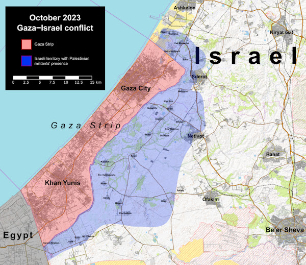
Mapping The Israel – Hamas War
Mapping the conflict in Israel and Gaza (Reuters)
Maps: Tracking the Attacks in Israel and Gaza (NYT)
Israel-Hamas war in maps and charts: Live Tracker (Al Jazeera)
The Israel-Hamas conflict in maps (Financial Times